Hyderabad

Featured Image of Hyderabad


Hyderabad is the capital city of Telangana. It covers 650 square kilometres of land on the Deccan Plateau. The ground sits 542 metres above sea level. The Musi River runs right through the main city. Over 10 million people live in this large urban area today. The city started back in the year 1591 under King Quli Qutb Shah.

Today, Hyderabad is a major hub for IT firms and medical research. It is known as the City of Pearls and Cyberabad. The city blends old forts with modern office towers. The 158-km Outer Ring Road helps people travel across the city. Metro rail also makes daily travel easier. These changes have helped Hyderabad grow as a popular place to buy a home.

Geographic Positioning: Hyderabad Location, Coordinates, and State Status


Hyderabad in which state is a basic query. It is the capital of Telangana and is no longer linked to Andhra Pradesh. The exact Hyderabad location sits at 17°21′42″ north and 78°28′59″ east. The ground is made of hard pink and grey granite stone. This thick rock layer gives a solid base for very tall towers. The weather stays warm and dry for most months of the year.

  • State Home: It is the official capital city of Telangana.
  • Land Height: The city rests at 542 metres above sea level.
  • Border Areas: It sits near Medak, Siddipet, and Sangareddy districts.
  • City Zones: The local municipal body runs 6 main zones and 30 circles.

Weather and Seasons: Local Hyderabad Climate


The weather in the city stays warm and dry most of the year. Summer begins in March and goes on till the end of May. May is the hottest month, with daytime heat hitting 40°C to 43°C. Monsoon rains start in June and last until September. Over these wet months, the city gets around 800 mm of rain.

Winter begins in late November and ends by early February. Night temperatures drop to a cool 14°C to 17°C. The dry winter air makes it the best time for outdoor city tours.

Postal Directory: Primary Hyderabad PIN Code Zones


A Hyderabad PIN code starts with the digits 500xxx. The local post uses this code system to sort mail for each area. More than 100 post offices serve the city today.

  • 500001 to 500008: Old city hubs like Abids, Koti, and the General Post Office.
  • 500032 to 500034: West job zones like Gachibowli, Madhapur, and HITEC City.
  • 500072 to 500084: Northwest areas like Kukatpally, Miyapur, and Kondapur.
  • 500002 to 500028: South historic spots near Charminar and Falaknuma.

The two biggest mail sorting hubs sit at Abids and Secunderabad rail station.

City Layout and Cartography: Reading the Hyderabad Map


A full Hyderabad map shows big ring roads around the city. The main road is the 158-kilometre, 8-lane Outer Ring Road. Cars drive up to 120 km/h on this wide toll road. The map spreads out from twin cities: Hyderabad and Secunderabad. A big lake named Hussain Sagar sits right in the middle. The western side grows fast along National Highway 65.

  • Nehru Outer Ring Road: A wide loop connecting outer spots like Shamshabad and Gachibowli.
  • PVNR Expressway: An 11.6-kilometre raised road built for fast airport trips.
  • Hussain Sagar Lake: A big historic lake set between the two twin cities.

Public Transit Network: Hyderabad Metro Rail and City Buses


The Hyderabad Metro covers more than 69 km across the city. It has three main lines: Red, Blue, and Green. These lines connect key business areas and help people travel to work. During busy hours, trains may arrive every 4 to 7 minutes.

The state bus service, TGSRTC, runs more than 3,000 buses every day. These buses connect inner residential pockets to outer suburban rail stops. The Multi-Modal Transport System (MMTS) also operates suburban local trains linking Falaknuma, Secunderabad, and Lingampalli.

Economy and Employment: The IT Hub and Genome Valley


The city ranks among India’s top economic engines for technology exports. HITEC City, Madhapur, and Gachibowli house tech campuses for Microsoft, Google, Amazon, and Meta. Over 900,000 software engineers work in these western tech corridors.

The city is also known as the vaccine capital of the world. The Genome Valley cluster in Shamirpet hosts over 200 life-science and pharma firms. Bharat Biotech, Biological E, and Dr. Reddy's Laboratories run major manufacturing plants here.

Interstate Transit and Connectivity: Key Hyderabad Distance Routes


The measured Hyderabad distance to other state capitals is quite short. Four major National Highways link the town to the rest of India. The airport in Shamshabad serves over 25 million flyers each year. Three big railway hubs run direct trains across the nation daily.

Destination City Highway Route Road Run (km) Rail Travel Time
Bengaluru (Karnataka) NH-44 570 km 9 to 11 hours
Mumbai (Maharashtra) NH-65 710 km 12 to 14 hours
Chennai (Tamil Nadu) NH-16 630 km 12 to 13 hours
Vijayawada (Andhra Pradesh) NH-65 275 km 4 to 5 hours
Warangal (Telangana) NH-163 148 km 2 to 3 hours

Cultural Heritage and Sights: Major Hyderabad Tourist Places


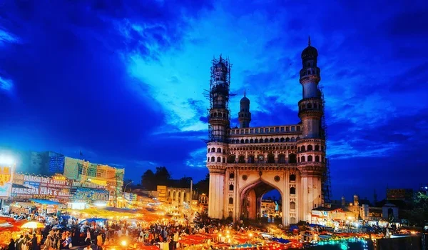
Top Hyderabad tourist places bring in millions of guests each year. The top sight is Charminar, built in 1591 with four tall towers. Right next to it sits Mecca Masjid, built with solid stone blocks.

  • Golconda Fort: An old hill fort known for sharp sound tricks and thick gates.
  • Qutb Shahi Tombs: Domed stone tombs set inside a quiet green park.
  • Chowmahalla Palace: An old royal home with tall halls and fine glass lights.
  • Salar Jung Museum: A large hall holding over 43,000 old art pieces.
  • Ramoji Film City: A huge film park spreading over 2,000 acres of land.

Western Residential Expansion: Kondapur Corridor and Auro Panorama


Western Hyderabad is the fastest-growing part of town today. Kondapur (PIN 500084) is a prime spot right by HITEC City. It sits along National Highway 65 and the Hafeezpet Flyover. Tech staff can reach Google in 4 km and Mindspace in 6 km.

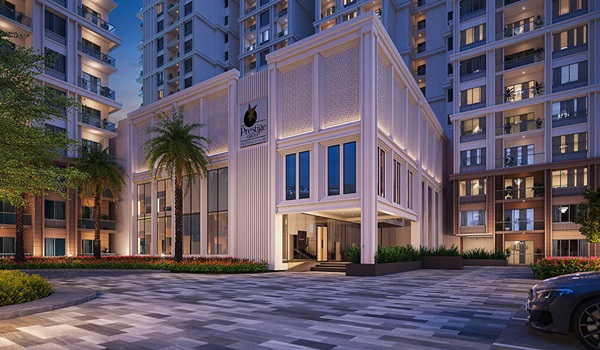
Auro Panorama by Auro Realty is a top new project here. It sits right in Kondapur, opposite NH 65 near Hafeezpet Flyover. The project covers 9 acres of land with 4 tall high-rise towers. Each tower rises 35 floors above the ground floor. A full 70% of the project area is open space with water views.

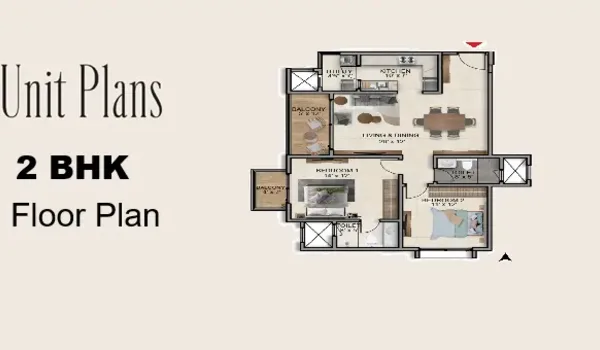
  • Flats and Sizes: It holds 1,500 homes in 2, 3, and 4 BHK layouts. A 2 BHK unit starts at 1,400 sq. ft. and ₹2.2 crore. A 3 BHK spans up to 1,860 sq. ft., and a 4 BHK reaches 2,200 sq. ft.
  • Road and Train Links: It sits right on NH 65. The Outer Ring Road is just 3 minutes away. HITEC City is 5 minutes away, and Gachibowli is 8 minutes away. Raidurg Metro Station is 5.9 km away.
  • Schools and Malls: It sits right opposite CHIREC School. Citizens Hospital and Sarath City Mall are both 5 minutes away.
  • Club Perks: It has a pool, gym, yoga deck, play park, and round-the-clock CCTV.
  • Key Dates: Pre-launch begins in October 2026. The full launch is set for 20 December 2026. Work wraps up by December 2030 (RERA status awaited).

FAQs


1. What is Hyderabad famous for?

Hyderabad is famous for Charminar, real pearls, and its large tech parks. It is also well known for royal food and big medicine firms.

2. Is Hyderabad expensive or cheap?

Hyderabad is cheap when you compare it to Mumbai or Delhi. One person spends about ₹25,000 to ₹40,000 each month on rent and food. A family spends around ₹65,000 to ₹1,00,000. Rent in tech belts is a bit higher, but local food is low-cost.

3. Is Hyderabad in Andhra Pradesh?

No, Hyderabad is not in Andhra Pradesh. It is the capital of Telangana. The ten-year joint-capital link between the two states ended in June 2024.

4. What is famous to eat in Hyderabad?

Hyderabad is famous for its spicy Dum Biryani and slow-cooked meat Haleem. People also love hot Irani Chai served with crisp Osmania biscuits. For dessert, locals eat Double Ka Meetha and sweet apricot bowls.

5. What makes Kondapur an attractive location for buying real estate in Hyderabad?

Kondapur is popular because it sits just 5 minutes from HITEC City. Projects like Auro Panorama offer gated homes near top schools, malls, and tech jobs.

Enquiry
Enquire Now